
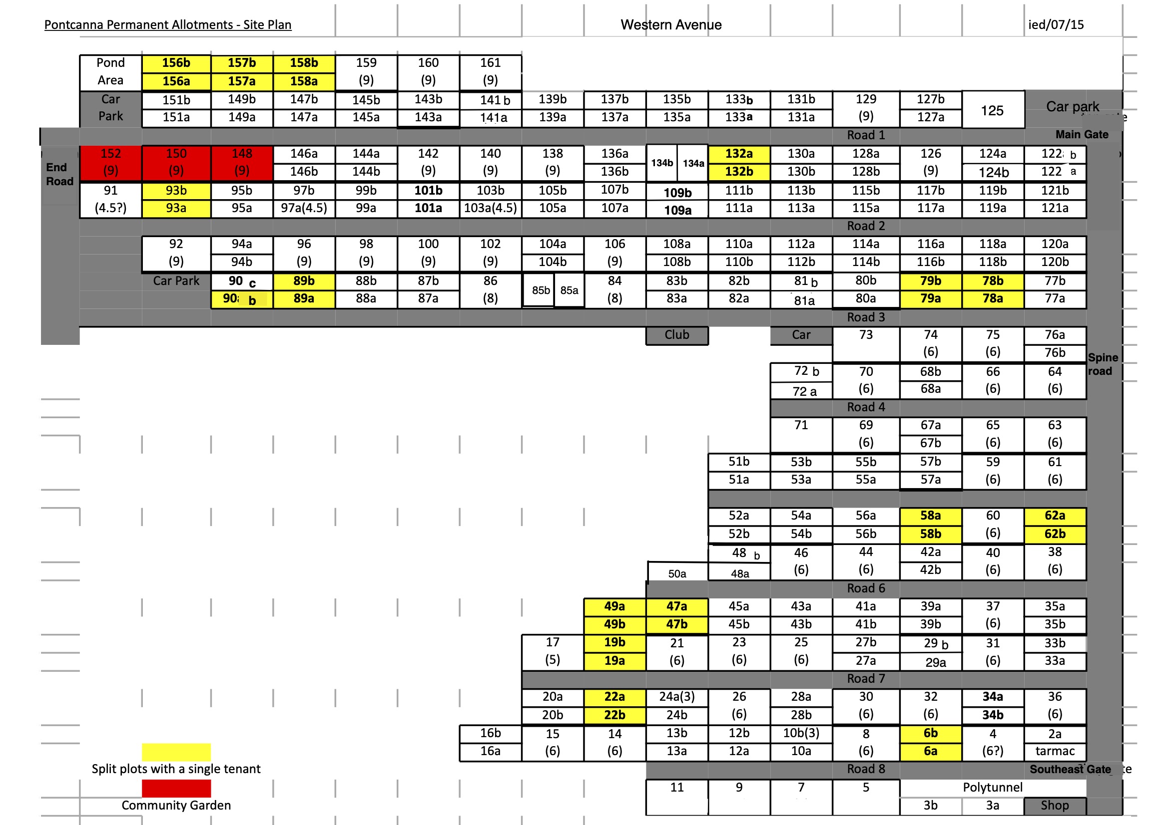
This schematic plan is as of May 2026. Please note, that some plots may since have been subdivided, and others reverted from subdivision to single plots. Just zoom in to assist in reading plot numbers if needed, or download this file for viewing. (However, this plan’s updated as necessary, so if saved, the link alone will expire from time-to-time.)
The map from the current LMA gives the geographical context, and also shows the general physical position as to Council-recognised paths and tracks etc:
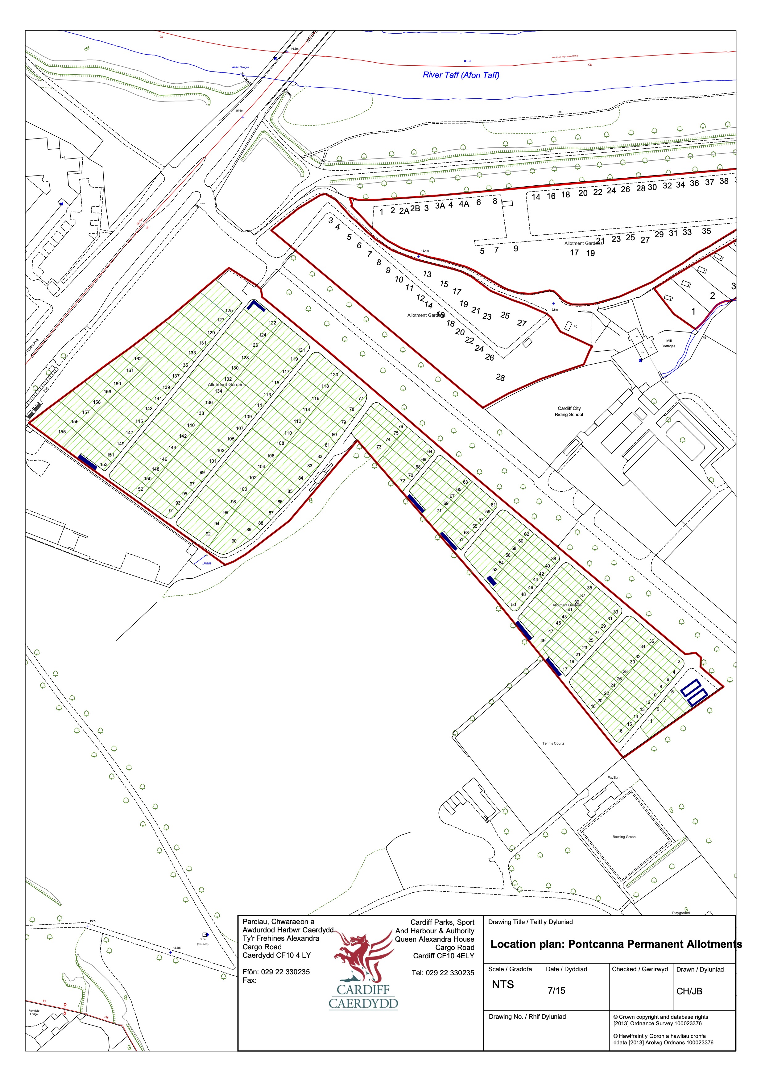
Please note that the LMA plan is some years old now. Plot sizes and boundaries etc. are therefore not to be relied upon for the present day position. Plots are offered to tenants on an “as seen” basis, not with reference to claimed defined boundaries on this plan.
